
GIS-Based Telecommunication Infrastructure Management Information System (GBTIMIS)
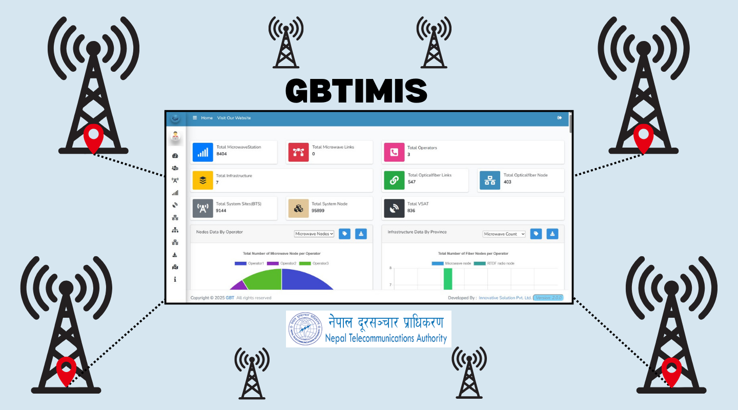
The GIS-Based Telecommunication Infrastructure Management Information System (GBTIMIS), developed by Innovative Solution Pvt. Ltd. for the Nepal Telecommunications Authority (NTA), is a national digital platform that integrates telecommunication infrastructure and network coverage data into a unified GIS environment.
First launched in 2015 and upgraded in 2020, GBTIMIS enables NTA to monitor, regulate, and plan telecom infrastructure and services across Nepal. The system maps BTS towers, microwave links, VSAT terminals, optical fiber routes, PSTN, and wireless networks, and now includes 2G/3G/4G coverage visualization aligned with Nepal’s new provincial and local boundaries.
Built entirely on open-source technologies, GBTIMIS provides interactive dashboards, API-based automation, and analytical tools for province-to-ward-level reporting. It supports real-time data exchange with NTA’s office automation system and helps generate quarterly MIS coverage maps.
Today, GBTIMIS serves as a core digital governance tool—empowering NTA to make data-driven decisions for national connectivity planning and telecommunication infrastructure development.